The river comes down
The Mississippi drains roughly forty percent of the contiguous United States, and in the winter of 1926–27 that entire basin was saturated. Rain fell almost without interruption across the central states through the autumn and into the new year, filling tributaries from the Ohio to the Arkansas before a single levee on the main stem had been tested. By the time the river crested in the lower valley in the spring of 1927, the pressure behind those embankments was unlike anything the flood-control apparatus of the time had been designed to handle.
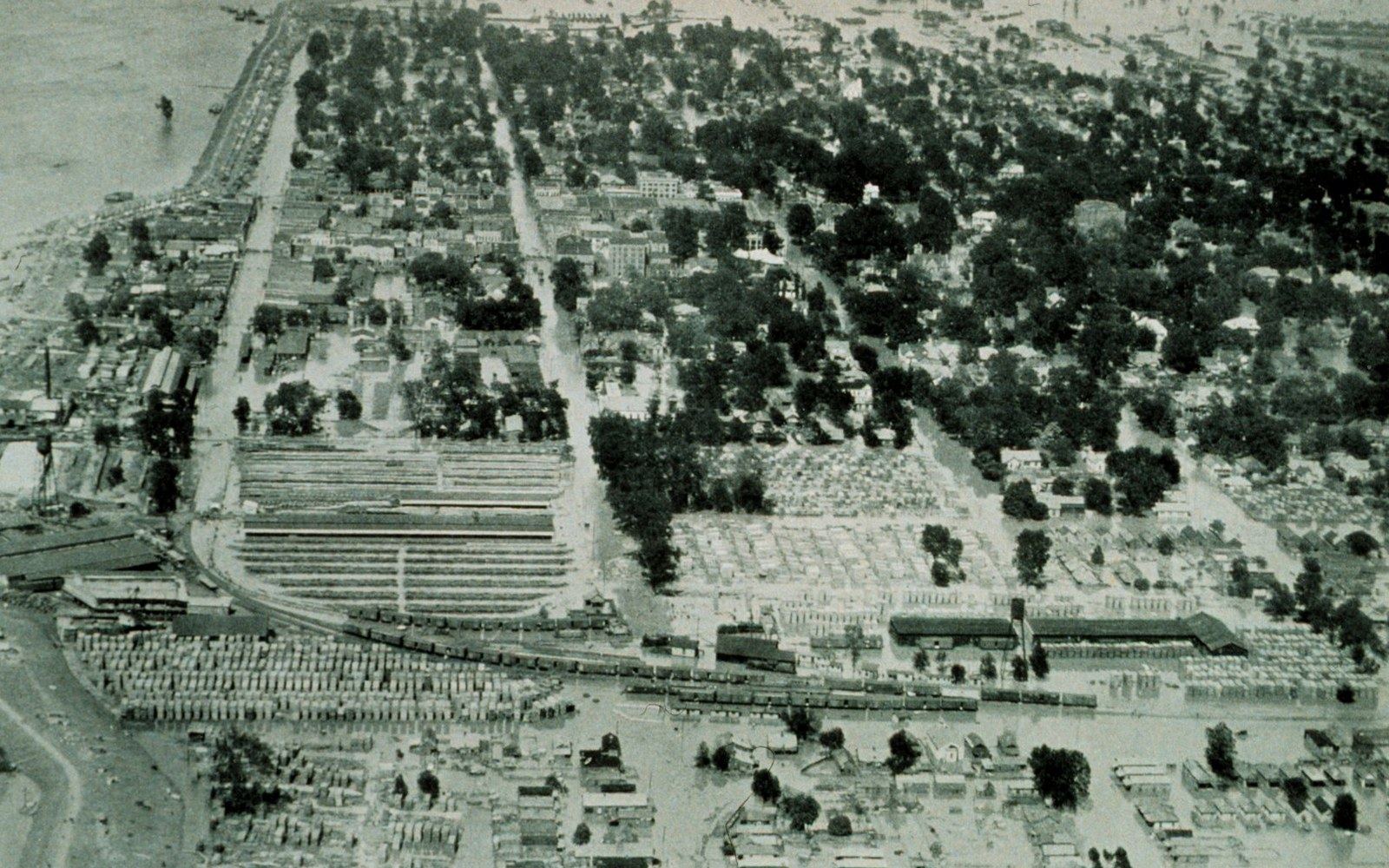
The breaks, when they came, were catastrophic in scale. The 1927 flood ultimately inundated roughly 27,000 square miles across seven states, with the Yazoo–Mississippi Delta absorbing some of the worst of it. The Mound Landing crevasse, which opened on the Mississippi levee in Bolivar County on April 21, sent a wall of water across the alluvial plain that was moving too fast and too deep for anything in its path. Overbank deposition — the annual gift of silt that had built the plain over millennia — became, in 1927, destruction at scale. The Sunflower River, the Yazoo River, every internal drainage channel in the Delta backed up or filled from the surface; the plain became a shallow inland sea that held water for weeks.
The human toll was enormous and unevenly distributed. Roughly 700,000 people were displaced across the affected region, the great majority of them Black sharecroppers and tenant farmers whose labor sustained the cotton economy. The Red Cross administered a network of refugee camps, but the conditions inside those camps — and the coercion that kept displaced Black laborers from leaving them — became part of the political record that followed. Herbert Hoover, then Secretary of Commerce, directed the federal relief effort ↗ and used the flood's visibility to build national political standing, though the relief operation's treatment of Black refugees would later become a point of documented historical criticism.
Read next
- Mississippi River Commission proposal
- higher main-stem levees, costs shared with local districts
- Jadwin Plan (adopted)
- levee improvement plus designated floodways and overflow corridors; hydraulic argument that extreme water needs a legal outlet
The law that followed
The existing framework for managing the Mississippi rested on the doctrine that the river was primarily a navigation problem, not a flood-control one. The Mississippi River Commission, created in 1879, had the authority to build and maintain levees in service of commerce — but the assumption encoded in its mandate was that private landowners and local levee boards carried primary responsibility for flood protection on the land side of the embankments. The 1927 flood destroyed that assumption in practice and made it politically untenable to sustain in law.
Congress passed the Flood Control Act of 1928 ↗, and the shift it encoded was fundamental. The federal government — operating through the US Army Corps of Engineers — accepted direct responsibility for constructing and maintaining a comprehensive flood-control system on the lower Mississippi. The cost would no longer be apportioned to local levee districts or state governments as a condition of federal assistance. The river, in law as in geography, became a national problem.
The technical instrument the Act authorized was a system in the modern sense: not simply higher levees, but a coordinated set of structures including floodways designed to carry overflow deliberately and safely away from populated areas, cutoffs to reduce the river's length and increase its gradient and velocity, and revetments — articulated concrete mattresses and similar structures — to hold the riverbed in place against the current's constant lateral pressure. The Atchafalaya and Boeuf floodways, both on the river's west bank, were designated as deliberate overflow corridors. The Army Corps began work on a scale that had no American precedent.
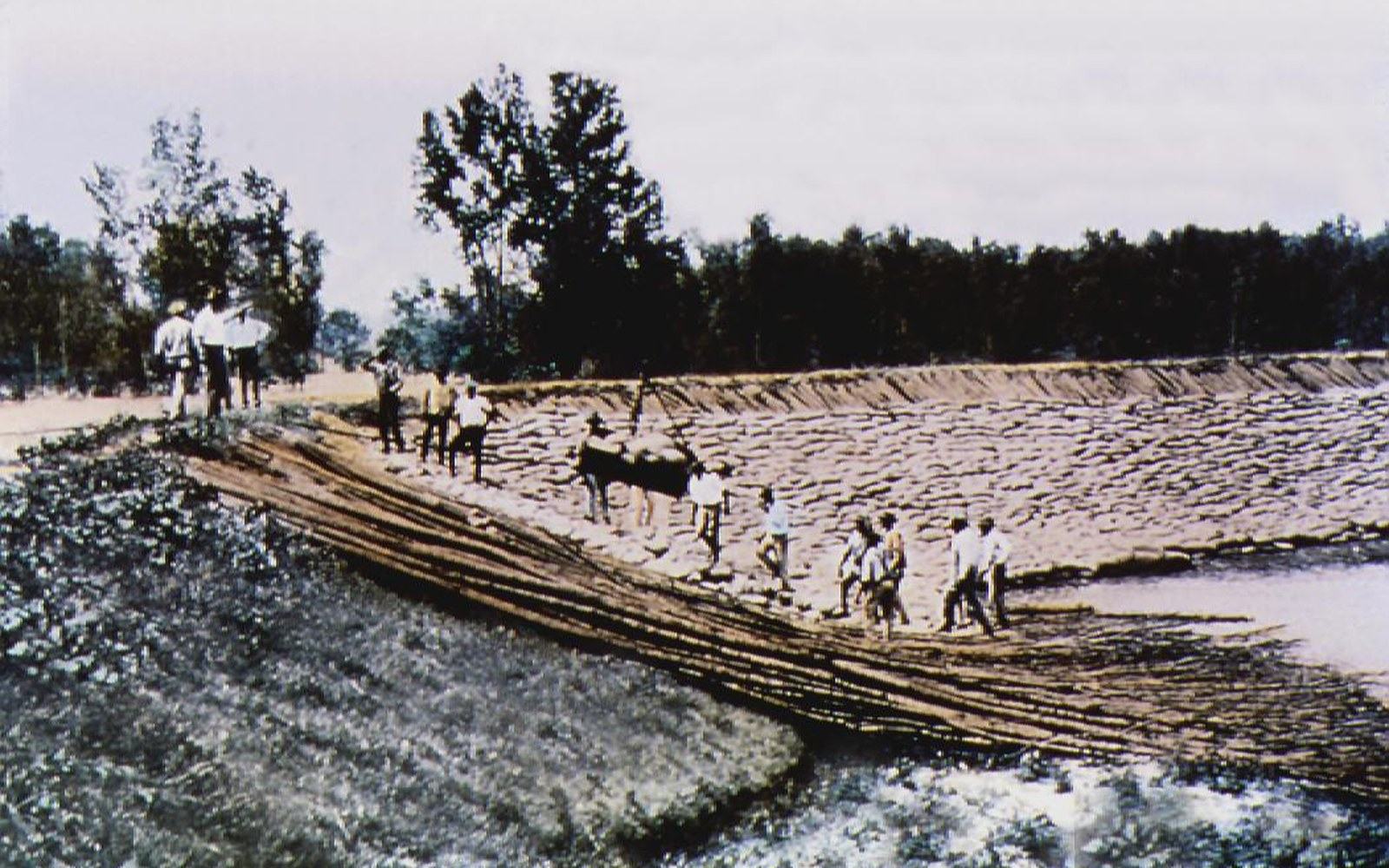
The Jadwin Plan, named for Army Chief of Engineers Maj. Gen. Edgar Jadwin, was the specific engineering program Congress approved. It rejected a proposal from the Mississippi River Commission that had emphasized still-higher main-stem levees, choosing instead a combination of levee improvement and controlled outlets. The argument was hydraulic: a river carrying that volume of water in extreme conditions needed somewhere legal to go, or it would find somewhere of its own choosing.
What it meant on the ground
For the Yazoo–Mississippi Delta, the practical consequence of 1928 unfolded over decades. The levee system grew taller, wider, and more continuous. The Corps' work on the main-stem levees and on the interior drainage — the pumping and floodway infrastructure of the Yazoo basin — changed the hydrology of the plain fundamentally. Land that had been too wet or too flood-prone to farm reliably became, over time, part of the cultivated agricultural surface. Bottomland hardwood forest that had persisted in low areas was cleared as drainage improved.
The 1927 flood also accelerated the social reorganization of the Delta that the following decades would complete. The displacement of hundreds of thousands of sharecroppers — many of whom had no reason to return to a system that had offered them a flooded camp, not a contract — contributed to the demographic pressure already building toward the Great Migration. Historians of the period, including Pete Daniel in his study of the 1927 disaster, have documented the ways in which the flood's disruption intersected with the economic and racial structures of the plantation system. The catastrophe did not by itself move people north, but it shook the arrangement that had held them in place.
The music that came out of the Delta in the years immediately following carried the flood's presence. Charley Patton recorded "High Water Everywhere" in 1929, naming specific places — Blytheville, Sumner, Leland, Greenville — and the sound was not metaphorical. Backwater blues was a documented genre responding to a documented event, by musicians who had lived inside it.
The cost would no longer be apportioned to local levee districts or state governments as a condition of federal assistance.
What 1927 settled, above everything else, was the question of who was responsible. The answer Congress gave in 1928 — that the federal government held the mandate, that the Army Corps would build and maintain the system, that the costs were national — restructured every relationship between the river and the people on its plain. The levees got higher. The bureaucratic apparatus grew. And the Mississippi kept moving, looking, as it always had, for a shorter route to the sea.
Elsewhere in The 1927 Water
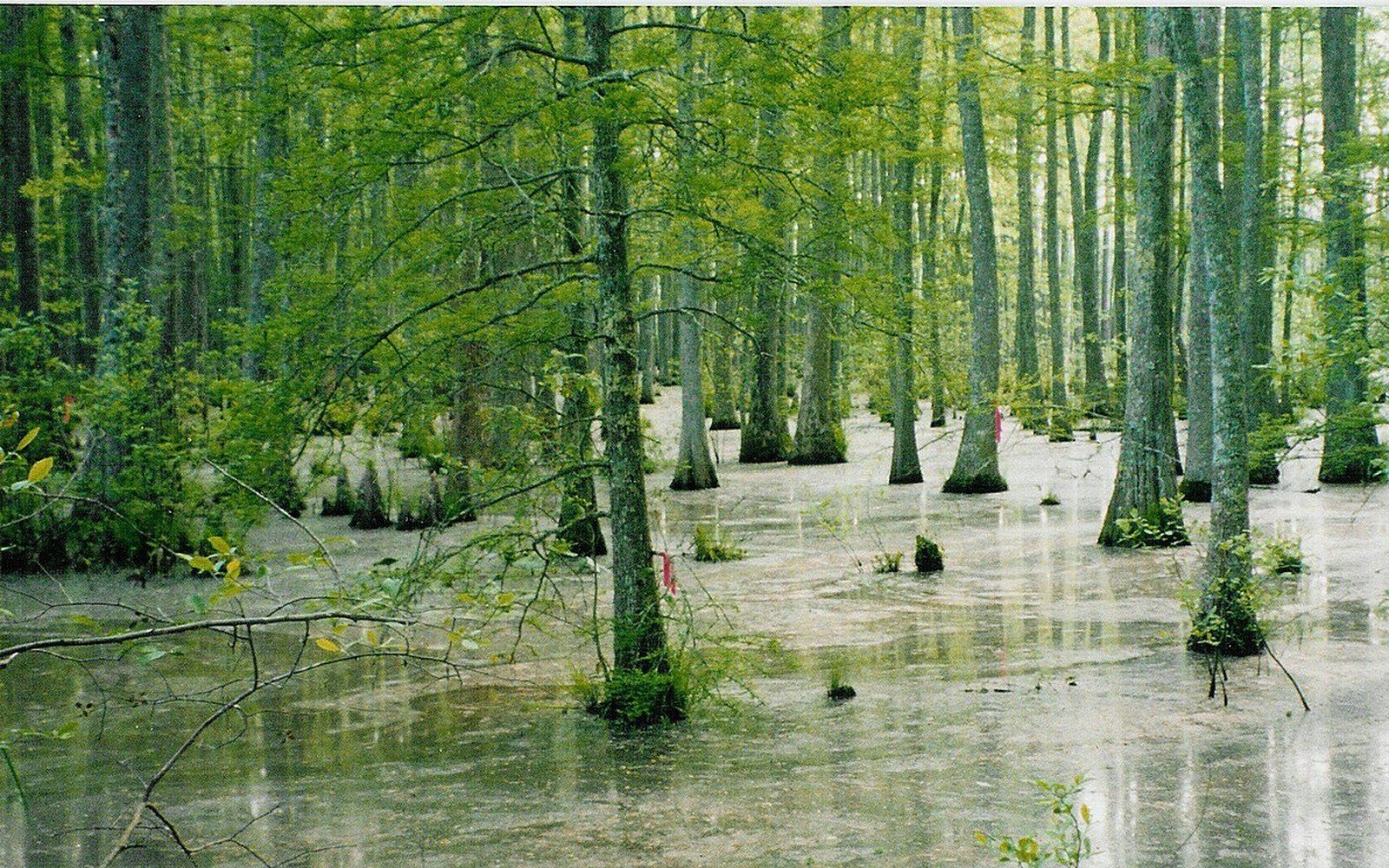
Bottomland forest became farmland
The plain was hardwood bottomland before it was cleared, and the remaining fragments are what conservation programmes now work with.
Flat Country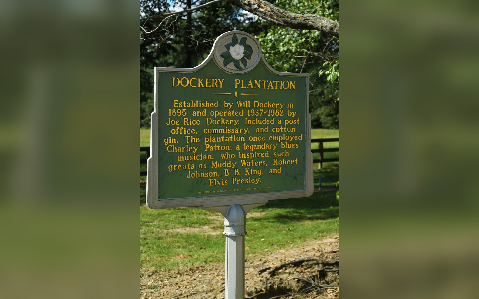
A plantation with a documented roster
Dockery Farms is cited as a place where several foundational players worked and played, which makes it a location rather than a legend.
Off Dockery
The earliest of the names
Charley Patton's recordings from 1929 onward are the earliest substantial body of Delta blues on record, and they are dated and catalogued.
Off Dockery